Project goal:
Ambon City, as the capital of Maluku Province, which is located in the Coastal Disaster Prone Area (KRB) of Ambon Island, requires efforts to mitigate the tsunami disaster, considering that 40% of tsunami events recorded in Indonesia during the 1600-2015 period occurred in the Maluku region. Making a tsunami disaster risk map is one of the mitigation efforts by mapping the level of risk and potential losses that a disaster can cause.
Solution
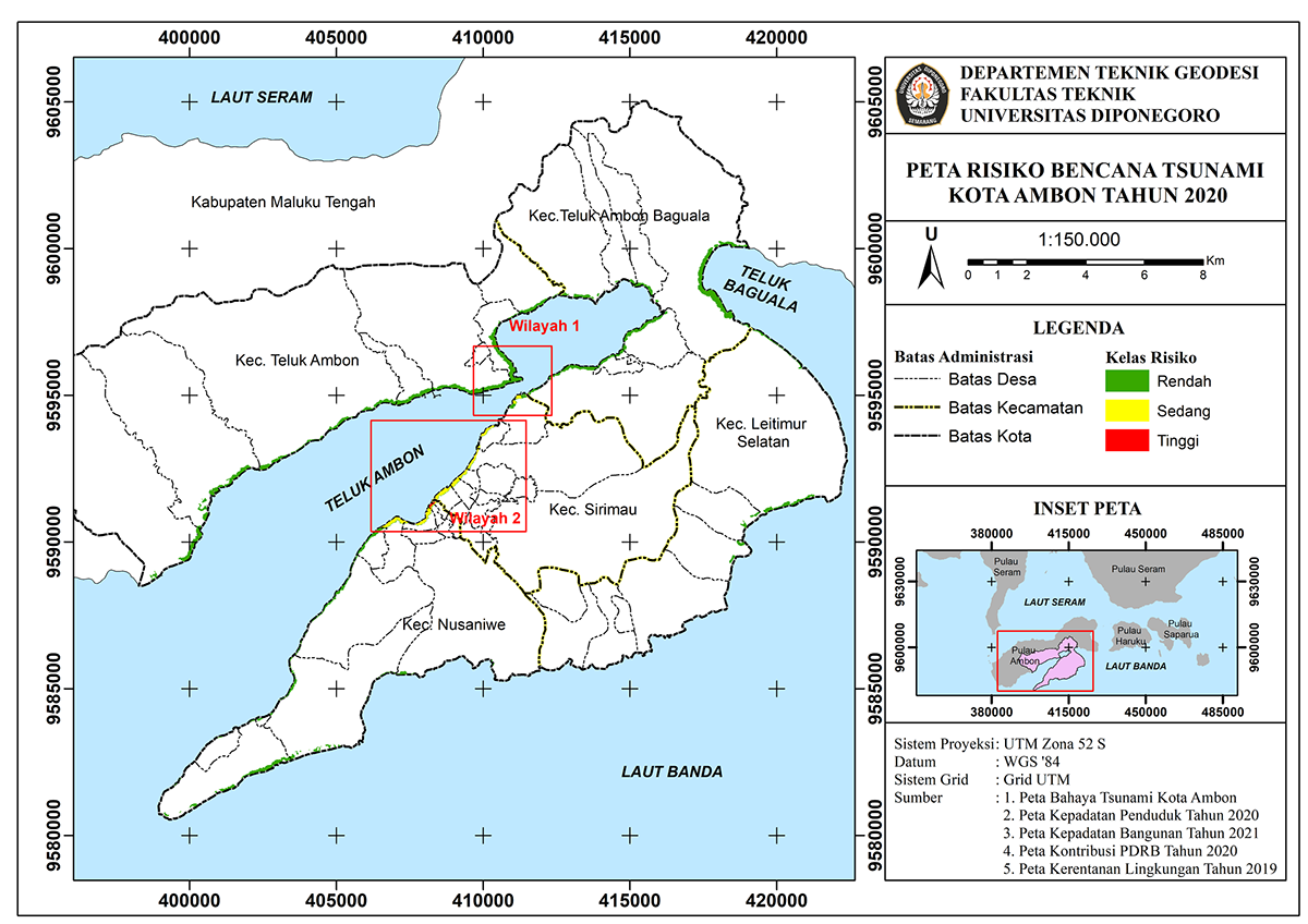
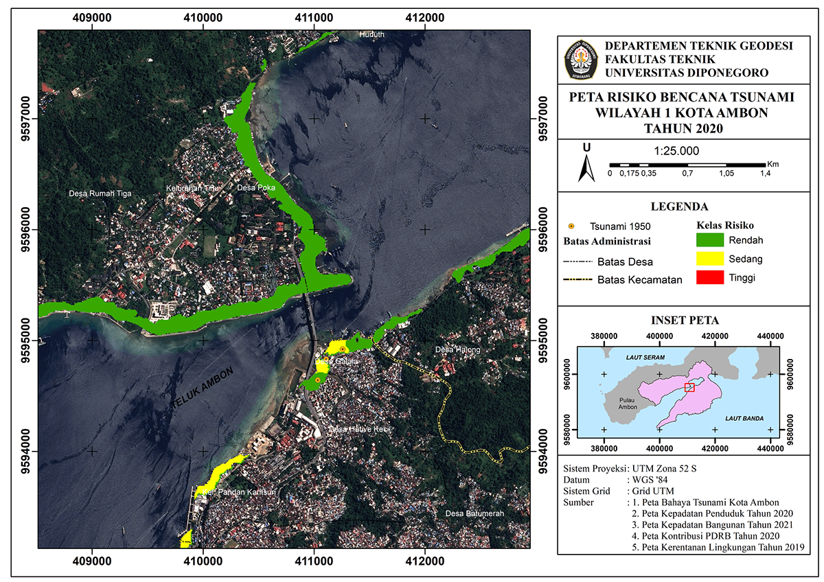
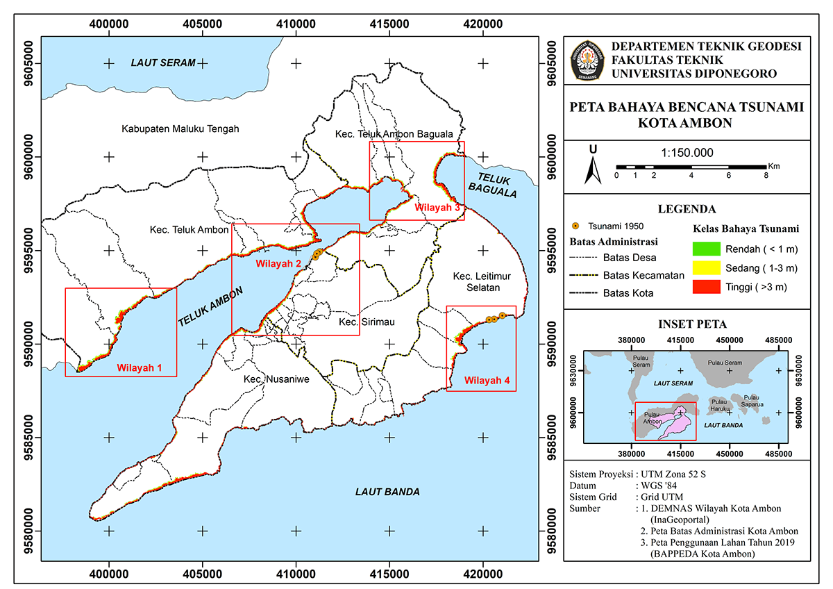
In this study, the tsunami risk mapping will use the Crunch Model with parameters that refer to Perka BNPB No. 2 of 2012. Based on the Crunch Model, the tsunami risk level is obtained by multiplying the hazard and vulnerability levels. Mapping the hazard level using the Hloss method with a tsunami model as high as 10 meters. Mapping the level of vulnerability using the overlay method and Analytical Hierarchy Process (AHP) to determine the weight of each parameter. The vulnerability level parameters consist of population density, building density, GRDP contribution, and the environment. The tsunami disaster risk study results found that the coast of Ambon City was dominated by low-risk areas with an area of 386.699 Ha or 89.256% of the total risk area. Medium risk level has an area of 43.962 Ha (10.147%) consisting of Sirimau District with an area of 26.836 Ha and Nusaniwe District with an area of 17.125 Ha. Two kelurahans have a high risk of a tsunami, namely Kelurahan Silale and Kelurahan Waihaong, with a risk area of 1,964 Ha and 2,172 Ha, respectively. The level of tsunami risk in Ambon City is low based on the processing results that have been obtained. This can be caused by uneven population growth and development and tends to be centered in the Sirimau and Nusaniwe sub-districts.